Magyarország legrégebbi virtuális antikváriuma.
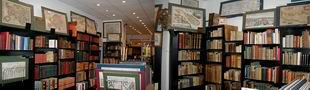
Sós Antikvárium
Tervezte és készítette:ko16765. könyv/földrajz, térképészet, útleírás berak a kosárba Abbé, Grenet: Atlas portatif à l'usage des collèges......(Világatlasz).Paris. ca.1782. kn. 44 p. kartonkötés. francia nyelvű.méret: 27x22 cm. ár: 990000 FORINT44 db kihajtható térkép. Teljes. A térképek mérete: 27x38 cm.
Határszínezett rézmetszet. ................................. Bound in the original or slightly later cartonnage binding, cover... |  |
te173. térkép/Amerika berak a kosárba Bonne, Rigobert: PARTIE MÉRIDIONALE, DE L'ANCIEN MÉXIQUE ( Mexico).Paris. 1787. rézmetszet.méret: 21x32 cm. lapméret: 26x39 cm. zöld paszpartuban. ép szél. ár: 36000 FORINTJó állapotú. Good condition. |  |
me4731. metszet/látkép/Magyarország/Budapest berak a kosárba Alt, Rudolf (rajzoló)- Sandmann, Xaver (litográfus): A kereskedelmi kar épülete Pesten.Wien. ca. 1845. litográfia.méret: 13x18 cm. lapméret: 20x27 cm. ár: 45000 FORINTMegjelent:
Malerische Ansichten von Ofen und Pesth”. Magyar kiadásának címe: „Festői Megtekintések Budára és Pestre”. Verlag L. T. Neumann, Wien. Gezeichnet von Rudolf Alt, litographier... |  |
